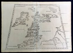
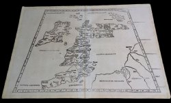
[Tabula Primae Europae] Untitled [BRITISH ISLES & IRELAND]
Published in Strasbourg 1513-1520
SKU: 45382
£4,000.00
Black and white woodcut (approx. 39.5 x 58cm.q) Martin Waldseemuller's important and scarce Ptolemaic map of the British Isles (more frequently found in the reduced-size format by Lorenz Fries published from 1522). The map was first published in Waldseemuller's edition of "... Geographiae Opus Novissima..." (1513) in which, for the first time, the classical Ptolemaic series of maps were displayed with comparable "modern" maps. The woodblock map shows the typically Ptolemaic outline of the British Isles with an elongated south-west and an eastward slanting Scotland. Ireland also appears with an elongated south-west corner and is located too far north. Slight crease to top of centre fold. OVERALL A VERY GOOD EXAMPLE.


 Red Dragon I.T. Ltd.

